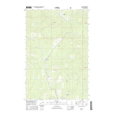
2017 Map of Jaype
USGS Topo · Published 2017About this map
Pierce anchors the southern edge of this landscape, a region deeply carved by the waters of Orofino Cr and its many tributaries. The area is defined by a network of timber and access roads, including Snake Creek Rd and Grangemont Rd, which connect small settlements like Jaype, Hollywood, and Cardiff. This 2017 edition reveals a landscape managed for resource extraction and aviation, evidenced by the Cptpa Headquarters Airport and the numerous named gulches like East Canal Gulch. The terrain is steeply dissected, with drainage systems such as Calhoun Cr, Reeds Cr, and Shanghai Cr dictating the placement of infrastructure. These topographic patterns highlight the transition between industrial timber lands and the more residential outskirts of Pierce, providing a clear record of land use and modern settlement distribution in this corner of Idaho.
Find a feature on this map
41 named features on this map. Tap any name to fly to it.
Don’t see what you’re looking for? This feature index may not catch every label — zoom into the map to look around manually.
Map Details
Editions of this 2017 Jaype Map
This is the sole edition of this map. No revisions or reprints were ever made.
Other maps of this area

1923 · Washington Creek
USGS Topo · 1:125,000

1924 · Weippe
USGS Topo · 1:125,000

1938 · Headquarters
USGS Topo · 1:48,000

1944 · Headquarters
USGS Topo · 1:62,500

1956 · Hamilton
USGS Topo · 1:250,000

1959 · Hamilton
USGS Topo · 1:250,000

1960 · Hamilton
USGS Topo · 1:250,000

1964 · Hamilton
USGS Topo · 1:250,000

1965 · French Mountain
USGS Topo · 1:24,000

1966 · Pierce
USGS Topo · 1:24,000