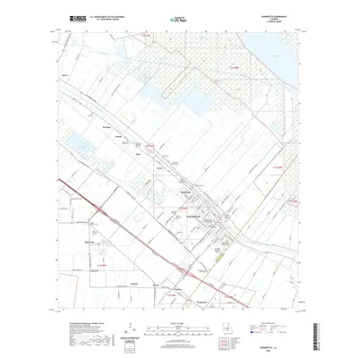
2020 Map of Jeanerette
USGS Topo · Published 2020About this map
Bayou Teche winds through the heart of the Acadiana region, serving as a historic corridor for the settlements of Jeanerette, Hubertville, and Loisel. The landscape is defined by the transition from agricultural tracts and small communities like Patoutville and Olivier to the extensive wetlands and marshlands of the Atchafalaya Basin to the northeast. This 2020 survey reveals a dense concentration of local heritage sites, particularly cemeteries such as Saint John the Evangelist Cem and Saint Nicholas Cem, which reflect the deep-rooted cultural and genealogical history of Iberia Parish. Transport and infrastructure are centered around the Le Maire Memorial Airport and a network of parish roads that follow the diagonal orientation of the original land grants. The northern reaches of the quadrangle are dominated by the waters of Lake Fausse Pointe and Tete Bayou, illustrating the complex interplay of natural waterways and man-made drainage like the Delahoussaye Canal.
Find a feature on this map
120 named features on this map. Tap any name to fly to it.
Don’t see what you’re looking for? This feature index may not catch every label — zoom into the map to look around manually.
Map Details
Editions of this 2020 Jeanerette Map
This is the sole edition of this map. No revisions or reprints were ever made.
Other maps of this area

1937 · Jeanerette
USGS Topo · 1:62,500

1937 · Derouen
USGS Topo · 1:62,500

1939 · St. Martinsville
USGS Topo · 1:62,500

1941 · Loreauville
USGS Topo · 1:62,500

1945 · New Orleans
USGS Topo · 1:250,000

1954 · Loreauville
USGS Topo · 1:62,500

1954 · Jeanerette
USGS Topo · 1:62,500

1954 · Baton Rouge
USGS Topo · 1:250,000

1956 · Baton Rouge
USGS Topo · 1:250,000

1957 · St. Martinville
USGS Topo · 1:62,500