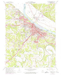
1967 Map of Jefferson City
USGS Topo · Published 1975About this map
Jefferson City serves as the focal point of this 1960s survey, where the Missouri state Capitol dominates the riverside skyline. The city’s institutional character is clearly defined by the sprawling State Penitentiary and the State Prison Farm across the Missouri River near Cedar City. Education and religious life are represented through the campus of Lincoln University and landmarks like the Carmelite Monastery and LaSalle Seminary.
Find a feature on this map
85 named features on this map. Tap any name to fly to it.
Don’t see what you’re looking for? This feature index may not catch every label — zoom into the map to look around manually.
Map Details
Editions of this 1967 Jefferson City Map
4 editions found
Other maps of this area

1886 · Jefferson City
USGS Topo · 1:125,000

1888 · Tuscumbia
USGS Topo · 1:125,000

1894 · Tuscumbia
USGS Topo · 1:125,000

1894 · Jefferson City
USGS Topo · 1:125,000

1939 · Jefferson City
USGS Topo · 1:24,000

1939 · Jefferson City
USGS Topo · 1:62,500

1942 · Jefferson City
USGS Topo · 1:62,500

1947 · Jefferson City
USGS Topo · 1:250,000

1948 · Centertown
USGS Topo · 1:62,500

1948 · Meta
USGS Topo · 1:62,500
Featured Places
- Jefferson City, MO
- Holts Summit, MO
- Wardsville, MO
- Cole Junction, Jefferson City
- North Jefferson, Jefferson City