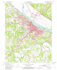
1967 Map of Jefferson City
USGS Topo · Published 1982About this map
Jefferson City sits at the heart of this mid-Missouri landscape, anchored by the Capitol and the sprawling campus of Lincoln University. The map reveals the intricate urban development of the state capital during the mid-to-late 20th century, showing the dense concentration of state institutions like the State Penitentiary and the State Highway Patrol Headquarters alongside established neighborhoods. The Missouri River serves as the dominant physical boundary, separating the city proper from North Jefferson, Cedar City, and the Jefferson City Memorial Airport to the north. Extensive genealogical and historical detail is present through numerous burial grounds, including the Jefferson City National Cem and the sprawling Riverview Cemetery. To the south, the terrain transitions into the loops of the Moreau River, where the Lincoln University Farm and smaller settlements like Wardsville mark the rural-urban fringe.
Find a feature on this map
73 named features on this map. Tap any name to fly to it.
Don’t see what you’re looking for? This feature index may not catch every label — zoom into the map to look around manually.
Map Details
Editions of this 1967 Jefferson City Map
4 editions found
Other maps of this area

1886 · Jefferson City
USGS Topo · 1:125,000

1888 · Tuscumbia
USGS Topo · 1:125,000

1894 · Tuscumbia
USGS Topo · 1:125,000

1894 · Jefferson City
USGS Topo · 1:125,000

1939 · Jefferson City
USGS Topo · 1:24,000

1939 · Jefferson City
USGS Topo · 1:62,500

1942 · Jefferson City
USGS Topo · 1:62,500

1947 · Jefferson City
USGS Topo · 1:250,000

1948 · Centertown
USGS Topo · 1:62,500

1948 · Meta
USGS Topo · 1:62,500
Featured Places
- Jefferson City, MO
- Holts Summit, MO
- Wardsville, MO
- Cole Junction, Jefferson City
- North Jefferson, Jefferson City