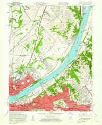
1960 Map of Jeffersonville
USGS Topo · Published 1961About this map
The Ohio River serves as the central artery and state boundary in this 1960s study, connecting the industrial hubs of Jeffersonville, Indiana, and Louisville, Kentucky. Large-scale riverfront infrastructure is evident, from the City Waterworks and Pumping Sta to the numerous islands like Sixmile Island and Towhead Island. The Indiana side reveals the extensive U S Military Reservation Indiana Arsenal, while the Kentucky side shows the suburban expansion of communities such as St Matthews and Indian Hills.
Find a feature on this map
100 named features on this map. Tap any name to fly to it.
Don’t see what you’re looking for? This feature index may not catch every label — zoom into the map to look around manually.
Map Details
Editions of this 1960 Jeffersonville Map
This is the sole edition of this map. No revisions or reprints were ever made.
Other maps of this area

1905 · Prospect
USGS Topo · 1:62,500

1907 · Louisville
USGS Topo · 1:62,500

1909 · Kosmosdale
USGS Topo · 1:48,000

1912 · Prospect
USGS Topo · 1:62,500

1912 · Kosmosdale
USGS Topo · 1:62,500

1937 · Jeffersonville
USGS Topo · 1:24,000

1937 · Charlestown
USGS Topo · 1:24,000

1938 · Owen
USGS Topo · 1:24,000

1938 · Speed
USGS Topo · 1:24,000

1939 · New Albany
USGS Topo · 1:24,000