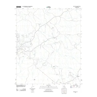
2012 Map of Jena East
USGS Topo · Published 2012About this map
The lowlands of LaSalle Parish are defined by the convergence of several waterways including Rhinehart Cr, Flat Cr, and Greens Cr as they flow toward the community of Rhinehart. This 2012 survey shows the residential outskirts of eastern Jena, characterized by a high density of family and community burial grounds such as Jena Cem, Dempsey Cem, and Nolley Cem. The landscape transitions from the grid-like streets of the town into the winding rural loops of Blade and Routon. Grounded landmarks like Poverty Knob rise above the drainage basins of Palmetto Cr and Lacy Br, while local infrastructure is marked by thoroughfares such as Oak Ridge Cutoff Rd and Blade Loop. This geographic record provides clear documentation of the rural road networks and scattered settlements that maintain the region's historical character.
Find a feature on this map
107 named features on this map. Tap any name to fly to it.
Don’t see what you’re looking for? This feature index may not catch every label — zoom into the map to look around manually.
Map Details
Editions of this 2012 Jena East Map
This is the sole edition of this map. No revisions or reprints were ever made.
Other maps of this area

1941 · Manifest
USGS Topo · 1:62,500

1941 · Jena
USGS Topo · 1:62,500

1941 · Harrisonburg
USGS Topo · 1:62,500

1953 · Alexandria
USGS Topo · 1:250,000

1953 · Natchez
USGS Topo · 1:250,000

1955 · Alexandria
USGS Topo · 1:250,000

1955 · Olla
USGS Topo · 1:62,500

1956 · Natchez
USGS Topo · 1:250,000

1958 · Jena
USGS Topo · 1:62,500

1959 · Natchez
USGS Topo · 1:250,000