
2019 Map of Jericho
USGS Topo · Published 2019About this map
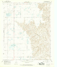
Jericho sits at the transition between the flat upland plains and the dissected drainage basins of the Texas Panhandle. This landscape is defined by the erosion of McClellan Creek and its tributaries, including Apple Orchard Cr and Big Sandy Creek, which carve deep draws through the terrain. In the northeast, the McClellan Creek National Grassland preserves a portion of this distinctive topography, where Turkey Roost overlooks the creek valley. For genealogists and local historians, the map identifies key community landmarks such as Jericho Cem and Boydston Cem. The presence of Interstate 40 follows the traditional transport corridor across the Gray and Donley county line, bridging the gap between the modern highway system and the network of older routes like Co Rd B and Vernon Rd that once serviced the area's agricultural life.
Find a feature on this map
31 named features on this map. Tap any name to fly to it.
Don’t see what you’re looking for? This feature index may not catch every label — zoom into the map to look around manually.
Map Details
Editions of this 2019 Jericho Map
This is the sole edition of this map. No revisions or reprints were ever made.
Other maps of this area

1954 · Amarillo
USGS Topo · 1:250,000

1958 · Amarillo
USGS Topo · 1:250,000

1960 · Groom
USGS Topo · 1:62,500

1962 · Roach Ranch
USGS Topo · 1:24,000

1962 · Griffin Ranch
USGS Topo · 1:24,000

1964 · Jericho
USGS Topo · 1:24,000

1964 · Rockledge
USGS Topo · 1:24,000

1966 · Grandview School
USGS Topo · 1:24,000

1968 · Taylor Ranch
USGS Topo · 1:24,000
1968 · Deep Lake
USGS Topo · 1:24,000