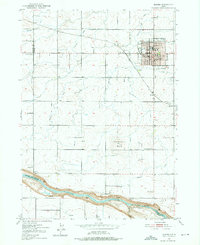
1950 Map of Jerome
USGS Topo · Published 1959About this map
Jerome serves as the focal point of this mid-century survey, revealing a well-established grid of schools, government buildings, and community infrastructure. The town's layout includes the Court House, City Hall, and multiple educational institutions such as High Sch and Washington Sch. Surrounding the settlement, a complex network of irrigation ditches and canals crisscrosses the landscape, indicating the high desert's transformation into a productive agricultural region. The Union Pacific railroad runs through the heart of the area, connecting Jerome Sta and the small siding at Hydra to broader markets.
Find a feature on this map
31 named features on this map. Tap any name to fly to it.
Don’t see what you’re looking for? This feature index may not catch every label — zoom into the map to look around manually.
Map Details
Editions of this 1950 Jerome Map
2 editions found
Other maps of this area

1950 · Niagara Springs
USGS Topo · 1:24,000

1950 · Filer
USGS Topo · 1:24,000

1950 · Jerome
USGS Topo · 1:24,000

1950 · Jerome
USGS Topo · 1:62,500

1951 · Clover
USGS Topo · 1:24,000

1955 · Twin Falls
USGS Topo · 1:250,000

1958 · Twin Falls
USGS Topo · 1:250,000

1964 · Falls City
USGS Topo · 1:24,000

1964 · Twin Falls
USGS Topo · 1:24,000
1971 · Wendell
USGS Topo · 1:24,000