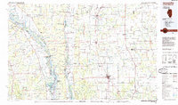
1985 Map of Jerseyville
USGS Topo · Published 1985About this map
The convergence of the Illinois River and Mississippi River dominates this mid-1980s landscape, where river-bottom lowlands and island networks transition into the uplands of Greene, Jersey, and Macoupin counties. The regional center of Jerseyville anchors the eastern prairie, supported by a network of smaller rail towns and agricultural hubs like White Hall, Roodhouse, and Greenfield. This planimetric study highlights the extensive conservation efforts along the river corridors, including the Mark Twain National Wildlife Refuge and Pere Marquette State Park at the river's mouth.
Find a feature on this map
127 named features on this map. Tap any name to fly to it.
Don’t see what you’re looking for? This feature index may not catch every label — zoom into the map to look around manually.
Map Details
Editions of this 1985 Jerseyville Map
2 editions found
Other maps of this area

1890 · Louisiana
USGS Topo · 1:125,000

1890 · Hermann
USGS Topo · 1:125,000

1903 · O'Fallon
USGS Topo · 1:125,000

1912 · Gillespie
USGS Topo · 1:62,500

1915 · Gillespie
USGS Topo · 1:62,500

1923 · Carlinville
USGS Topo · 1:48,000

1924 · Winchester
USGS Topo · 1:48,000

1924 · Waverly
USGS Topo · 1:62,500

1924 · Roodhouse
USGS Topo · 1:62,500

1924 · Griggsville
USGS Topo · 1:62,500