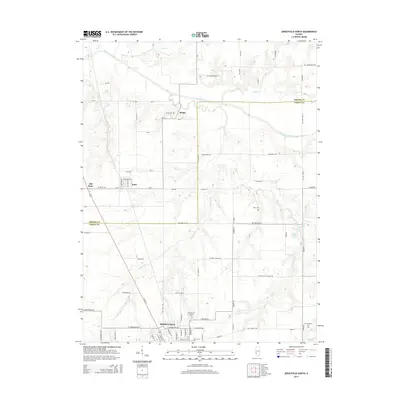
2015 Map of Jerseyville North
USGS Topo · Published 2015About this map
Jerseyville anchor the southern portion of this landscape, where the street grid expands into residential developments along W Fairground Ave and N State St. The area transitions northward into a pattern of rural farmsteads and creek valleys, notably where Macoupin Creek and Taylor Cr wind through the border between Greene Co and Jersey Co. Several small, established settlements like Kane and Jalapa are documented alongside their historic burial grounds, including the Burch Cem and Keller Cem.
Find a feature on this map
77 named features on this map. Tap any name to fly to it.
Don’t see what you’re looking for? This feature index may not catch every label — zoom into the map to look around manually.
Map Details
Editions of this 2015 Jerseyville North Map
This is the sole edition of this map. No revisions or reprints were ever made.
Other maps of this area

1924 · Roodhouse
USGS Topo · 1:62,500

1925 · Brighton
USGS Topo · 1:62,500

1926 · Roodhouse
USGS Topo · 1:62,500

1928 · Brighton
USGS Topo · 1:62,500

1930 · Jerseyville
USGS Topo · 1:62,500

1932 · Greenfield
USGS Topo · 1:62,500

1933 · Jerseyville
USGS Topo · 1:62,500

1948 · Quincy
USGS Topo · 1:250,000

1956 · Quincy
USGS Topo · 1:250,000
1983 · Boyer Creek
USGS Topo · 1:24,000