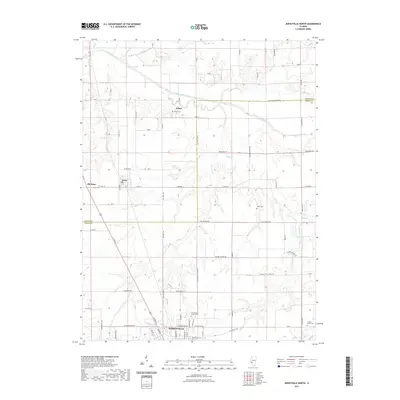
2021 Map of Jerseyville North
USGS Topo · Published 2021About this map
The northern reaches of Jerseyville and the agricultural transition between Jersey and Greene counties define this modern survey of central Illinois. The landscape is carved by the winding course of Macoupin Creek, which flows westward through a network of small tributaries including Bear Cr, Taylor Cr, and Phils Cr. This drainage pattern influenced the historical placement of rural cemeteries and the alignment of roads like N Macoupin Creek Rd and Witt Mill Rd.
Find a feature on this map
75 named features on this map. Tap any name to fly to it.
Don’t see what you’re looking for? This feature index may not catch every label — zoom into the map to look around manually.
Map Details
Editions of this 2021 Jerseyville North Map
This is the sole edition of this map. No revisions or reprints were ever made.
Other maps of this area

1924 · Roodhouse
USGS Topo · 1:62,500

1925 · Brighton
USGS Topo · 1:62,500

1926 · Roodhouse
USGS Topo · 1:62,500

1928 · Brighton
USGS Topo · 1:62,500

1930 · Jerseyville
USGS Topo · 1:62,500

1932 · Greenfield
USGS Topo · 1:62,500

1933 · Jerseyville
USGS Topo · 1:62,500

1948 · Quincy
USGS Topo · 1:250,000

1956 · Quincy
USGS Topo · 1:250,000
1983 · Boyer Creek
USGS Topo · 1:24,000