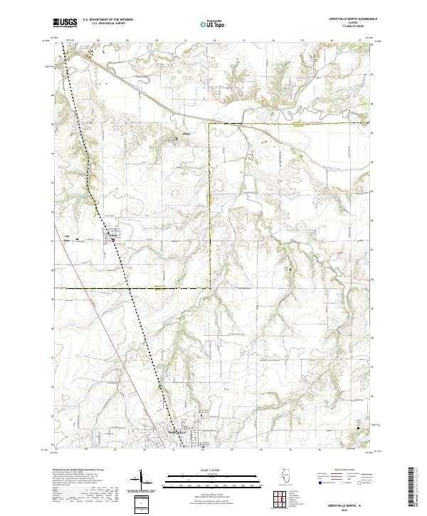
2024 Map of Jerseyville North
USGS Topo · Published 2024About this map
The northern reaches of Jerseyville and the surrounding agricultural corridor of Jersey and Greene Counties are detailed in this contemporary survey. This landscape is defined by the winding course of Macoupin Creek in the north and the transition between established settlements like Kane and the older site of Old Kane. The map serves as a vital resource for genealogical research, documenting several rural burial grounds including Saint Francis Xaviers Cem, Oak Grove Cem, and the small Luckey - Weber Cem near the eastern border. Local infrastructure is anchored by a grid of named rural routes such as Witt Mill Rd and Victory School Rd, which highlight the area's history of one-room schoolhouses and milling. The drainage patterns of De Arcy Branch and Phils Creek provide a clear view of the natural topography that shaped early Illinois prairie farmsteads.
Find a feature on this map
49 named features on this map. Tap any name to fly to it.
Don’t see what you’re looking for? This feature index may not catch every label — zoom into the map to look around manually.
Map Details
Editions of this 2024 Jerseyville North Map
This is the sole edition of this map. No revisions or reprints were ever made.
Other maps of this area

1924 · Roodhouse
USGS Topo · 1:62,500

1925 · Brighton
USGS Topo · 1:62,500

1926 · Roodhouse
USGS Topo · 1:62,500

1928 · Brighton
USGS Topo · 1:62,500

1930 · Jerseyville
USGS Topo · 1:62,500

1932 · Greenfield
USGS Topo · 1:62,500

1933 · Jerseyville
USGS Topo · 1:62,500

1948 · Quincy
USGS Topo · 1:250,000

1956 · Quincy
USGS Topo · 1:250,000
1983 · Boyer Creek
USGS Topo · 1:24,000