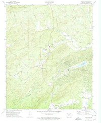
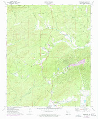
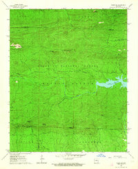
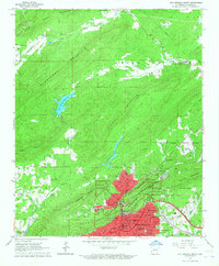
1972 Map of Jessieville
USGS Topo · Published 1974About this map
The Middle Fork Saline River winds through this section of the Ouachita Mountains, where small settlements like Jessieville and Blakely sit at the edge of the Ouachita National Forest. The landscape is a transition between the protected timberlands of the north and the expanding development of Hot Springs Village to the southeast, where Lake DeSoto and a nearby golf course mark a shift in land use. Genealogists will find several rural landmarks of interest, including the Bethlehem Ch and Shiloh Cem, which anchor long-standing communities along the winding creek valleys.
Find a feature on this map
44 named features on this map. Tap any name to fly to it.
Don’t see what you’re looking for? This feature index may not catch every label — zoom into the map to look around manually.
Map Details
Editions of this 1972 Jessieville Map
2 editions found
Other maps of this area

1890 · Benton
USGS Topo · 1:125,000

1890 · Hot Springs
USGS Topo · 1:125,000

1894 · Hot Springs
USGS Topo · 1:125,000

1894 · Benton
USGS Topo · 1:125,000

1955 · Little Rock
USGS Topo · 1:250,000

1956 · Little Rock
USGS Topo · 1:250,000

1960 · Little Rock
USGS Topo · 1:250,000
1963 · Paron SW
USGS Topo · 1:24,000

1964 · Little Rock
USGS Topo · 1:250,000
1966 · Hot Springs North
USGS Topo · 1:24,000