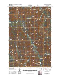
2011 Map of Jim White Ridge
USGS Topo · Published 2011About this map
Jim White Ridge anchors this landscape in Union County, where the topography is defined by the winding course of the Minam River and its numerous tributaries. This 2011 survey captures a wilderness area shaped by distinct geographical basins and high peaks like Goat Mountain and Bald Mountain. The drainage network is particularly dense here, with Whoopee Creek, Garwood Creek, and Jungle Creek feeding into the main river systems. Notable landmarks include Minam Falls and the large area identified as Big Burn, suggesting the long-term impact of forest fires on the local environment.
Find a feature on this map
34 named features on this map. Tap any name to fly to it.
Don’t see what you’re looking for? This feature index may not catch every label — zoom into the map to look around manually.
Map Details
Editions of this 2011 Jim White Ridge Map
This is the sole edition of this map. No revisions or reprints were ever made.
Other maps of this area

1906 · Telocaset
USGS Topo · 1:125,000

1954 · Eagle Cap
USGS Topo · 1:62,500

1955 · Grangeville
USGS Topo · 1:250,000

1957 · Enterprise
USGS Topo · 1:62,500

1959 · Grangeville
USGS Topo · 1:250,000

1965 · China Cap
USGS Topo · 1:24,000

1965 · Fox Point
USGS Topo · 1:24,000
1965 · Mount Moriah
USGS Topo · 1:24,000

1965 · Little Catherine Creek
USGS Topo · 1:24,000
1965 · Mt. Fanny
USGS Topo · 1:24,000