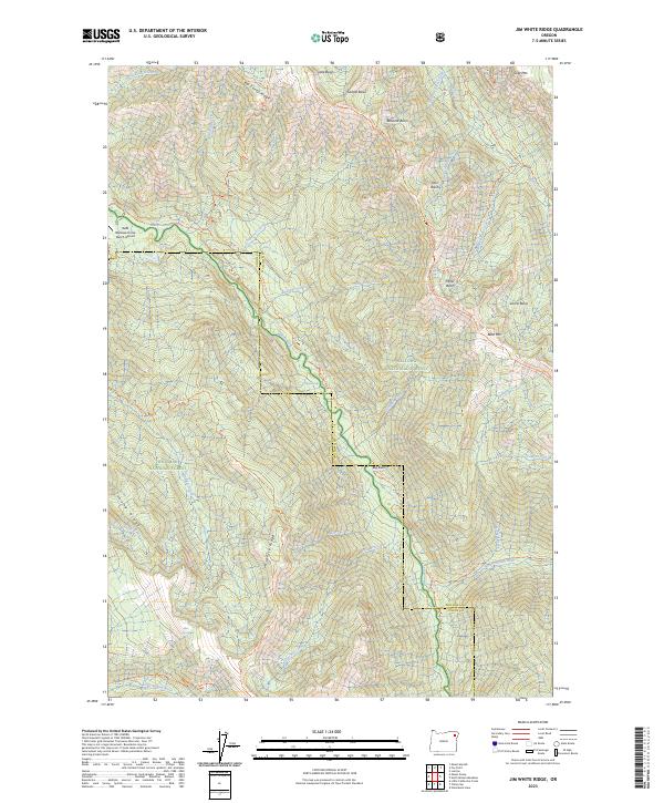
2023 Map of Jim White Ridge
USGS Topo · Published 2023About this map
The Minam River corridor dominates this high-country landscape on the border of Wallowa CO and Union CO. This remote wilderness territory, situated within the Wallowa National Forest and Whitman National Forest, is defined by its deep river basins and prominent ridges like Jim White Ridge and Big Sheep Ridge. The map documents a strictly backcountry infrastructure, centered on the Reds Wallowa Horse Ranch Airport and an extensive network of pack trails, including the Minam River Trl and Miners Basin Trl.
Find a feature on this map
54 named features on this map. Tap any name to fly to it.
Don’t see what you’re looking for? This feature index may not catch every label — zoom into the map to look around manually.
Map Details
Editions of this 2023 Jim White Ridge Map
This is the sole edition of this map. No revisions or reprints were ever made.
Other maps of this area

1906 · Telocaset
USGS Topo · 1:125,000

1954 · Eagle Cap
USGS Topo · 1:62,500

1955 · Grangeville
USGS Topo · 1:250,000

1957 · Enterprise
USGS Topo · 1:62,500

1959 · Grangeville
USGS Topo · 1:250,000

1965 · China Cap
USGS Topo · 1:24,000

1965 · Fox Point
USGS Topo · 1:24,000
1965 · Mount Moriah
USGS Topo · 1:24,000

1965 · Little Catherine Creek
USGS Topo · 1:24,000
1965 · Mt. Fanny
USGS Topo · 1:24,000