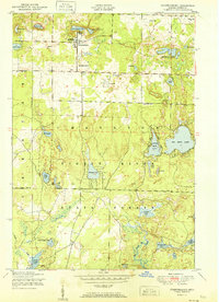
1951 Map of Johannesburg
USGS Topo · Published 1951About this map
Johannesburg sits at the heart of this Michigan landscape, serving as a hub for local families and seasonal visitors at the mid-century. The settlement is anchored by the Charlton Town Hall and Church and the Full Gospel Church, with the Johannesburg Cemetery located just to the south. The surrounding terrain is defined by its glacial lake density, including the prominent Big Bear Lake and the cluster known as the Traverse Lakes.
Find a feature on this map
41 named features on this map. Tap any name to fly to it.
Don’t see what you’re looking for? This feature index may not catch every label — zoom into the map to look around manually.
Map Details
Editions of this 1951 Johannesburg Map
2 editions found

Other maps of this area

1949 · Lewiston
USGS Topo · 1:62,500

1949 · Otsego Lake
USGS Topo · 1:62,500

1950 · Lewiston
USGS Topo · 1:24,000

1950 · Comstock Hills
USGS Topo · 1:24,000

1950 · Johannesburg
USGS Topo · 1:24,000

1950 · Lovells
USGS Topo · 1:24,000

1950 · Turtle Lake
USGS Topo · 1:24,000

1951 · K P Lake
USGS Topo · 1:24,000

1951 · Comstock Hills
USGS Topo · 1:24,000

1951 · Lovells
USGS Topo · 1:24,000