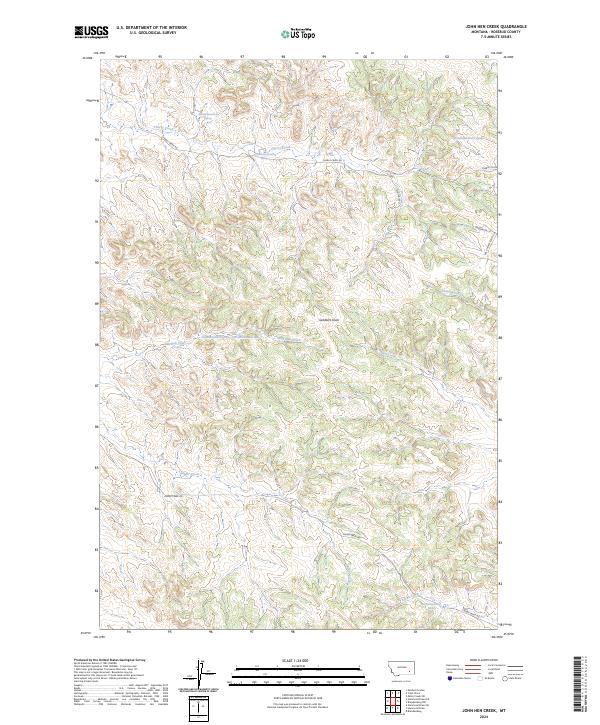
2024 Map of John Hen Creek
USGS Topo · Published 2024About this map
Gobblers Knob rises as a central landmark in this high plains landscape of Rosebud County, where the terrain is defined by a dense network of seasonal drainages and springs. The map documents the intricate branching of John Hen Creek and Snider Creek, which carve deep contours through the section lines of this rural expanse. Local ranching access is facilitated by a network of private and county roads, including Cherry Creek Rd and Red Shale Rd, which follow the natural rise and fall of the ridges. Numerous named springs, such as 03N43E26ACAC01 Spring and 02N44E33CACD01 Spring, indicate the vital water sources essential for livestock in this portion of Montana. The layout of Wild Horse Ranch Ln and Sagebrush Ln in the eastern sections suggests modern residential or ranching divisions superimposed on the traditional township and range grid.
Find a feature on this map
25 named features on this map. Tap any name to fly to it.
Don’t see what you’re looking for? This feature index may not catch every label — zoom into the map to look around manually.
Map Details
Editions of this 2024 John Hen Creek Map
This is the sole edition of this map. No revisions or reprints were ever made.
Other maps of this area

1954 · Hardin
USGS Topo · 1:250,000

1954 · Forsyth
USGS Topo · 1:250,000

1957 · Hardin
USGS Topo · 1:250,000

1957 · Forsyth
USGS Topo · 1:250,000

1958 · Forsyth
USGS Topo · 1:250,000

1958 · Hardin
USGS Topo · 1:250,000
1969 · Miller Creek SW
USGS Topo · 1:24,000
1971 · Brandenberg NW
USGS Topo · 1:24,000

1971 · Hammond Draw NW
USGS Topo · 1:24,000

1971 · Hammond Draw
USGS Topo · 1:24,000