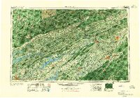
1955 Map of Johnson City
USGS Topo · Published 1955About this map
Cumberland Mountains and the long, parallel ridges of the Appalachians dominate this mid-century view of the Tri-Cities and East Tennessee. The landscape is defined by massive river impoundments, including Norris Reservoir, Cherokee Reservoir, and South Holston Lake, which reshaped the valleys of the Clinch River and Holston River during the era of hydroelectric development. Major industrial and transit hubs like Johnson City, Kingsport, and Bristol anchor the region, connected by the Southern and Louisville and Nashville railroads.
Find a feature on this map
72 named features on this map. Tap any name to fly to it.
Don’t see what you’re looking for? This feature index may not catch every label — zoom into the map to look around manually.
Map Details
Editions of this 1955 Johnson City Map
This is the sole edition of this map. No revisions or reprints were ever made.
Other maps of this area

1883 · Morristown
USGS Topo · 1:125,000

1886 · Knoxville
USGS Topo · 1:125,000

1886 · Grundy
USGS Topo · 1:125,000

1886 · Cumberland Gap
USGS Topo · 1:125,000

1887 · Jonesville
USGS Topo · 1:125,000

1888 · Cumberland Gap
USGS Topo · 1:125,000

1890 · Whitesburg
USGS Topo · 1:125,000

1890 · Grundy
USGS Topo · 1:125,000

1890 · Williamsburg
USGS Topo · 1:125,000

1891 · Tazewell
USGS Topo · 1:125,000