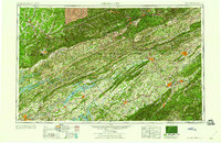
1960 Map of Johnson City
USGS Topo · Published 1960About this map
The Southern Appalachians of the mid-twentieth century are defined by the massive water control projects of the Tennessee Valley Authority. This 1954 revision displays the significant expansion of the regional hydroelectric infrastructure, prominently featuring the Norris Reservoir, Cherokee Reservoir, and Douglas Reservoir. These artificial lakes transformed the valleys between the Clinch Mountain and Copper Ridge, fundamentally altering the local economy and transportation networks that once relied on free-flowing rivers like the Holston River and Nolichucky River.
Find a feature on this map
44 named features on this map. Tap any name to fly to it.
Don’t see what you’re looking for? This feature index may not catch every label — zoom into the map to look around manually.
Map Details
Editions of this 1960 Johnson City Map
This is the sole edition of this map. No revisions or reprints were ever made.
Other maps of this area

1883 · Morristown
USGS Topo · 1:125,000

1886 · Knoxville
USGS Topo · 1:125,000

1886 · Grundy
USGS Topo · 1:125,000

1886 · Cumberland Gap
USGS Topo · 1:125,000

1887 · Jonesville
USGS Topo · 1:125,000

1888 · Cumberland Gap
USGS Topo · 1:125,000

1890 · Whitesburg
USGS Topo · 1:125,000

1890 · Grundy
USGS Topo · 1:125,000

1890 · Williamsburg
USGS Topo · 1:125,000

1891 · Tazewell
USGS Topo · 1:125,000