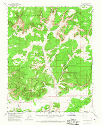
1954 Map of Johnson
USGS Topo · Published 1967About this map
Johnson (Site) serves as a central reference point in this mid-century survey of Kane County, where the settlement patterns of ranching families are etched into a landscape of dramatic geological benches. The map details a transition from the Skutumpah Terrace down through the White Cliffs to the Vermilion Cliffs, recording the locations of Bunting Ranch, Granary Ranch, and Robinson Ranch. These remote outposts relied on the drainage of Johnson Wash and various springs like Hog Canyon Spring and Ram Spring.
Find a feature on this map
73 named features on this map. Tap any name to fly to it.
Don’t see what you’re looking for? This feature index may not catch every label — zoom into the map to look around manually.
Map Details
Editions of this 1954 Johnson Map
3 editions found

Other maps of this area

1886 · Kanab
USGS Topo · 1:250,000

1886 · Kaibab
USGS Topo · 1:250,000

1953 · Cedar City
USGS Topo · 1:250,000

1953 · Grand Canyon
USGS Topo · 1:250,000

1954 · Buckskin Gulch NW
USGS Topo · 1:24,000

1954 · Buckskin Gulch SW
USGS Topo · 1:24,000

1954 · Johnson SE
USGS Topo · 1:24,000

1954 · Johnson NE
USGS Topo · 1:24,000

1954 · Kanab SE
USGS Topo · 1:24,000

1954 · Shinarump NW
USGS Topo · 1:24,000