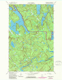
1967 Map of Johnson Lake
USGS Topo · Published 1987About this map
The Vermilion River and its dramatic landscape define this portion of St. Louis County, where the river flows through the steep-walled Vermilion Gorge towards the southern edge of Voyageurs National Park. This map shows a complex network of glacial lakes and portage trails within the Kabetogama State Forest and Superior National Forest. Land use in the late 1960s was primarily recreational and conservation-focused, though a Gravel Pit south of Franklin Lake suggests localized industrial activity. Portions of Johnson Lake and Mukooda Lake dominate the northern terrain, while the Vermilion Falls Picnic Area provides a specific point of access to the river's unique features. The inclusion of several Portage labels indicates the historical and ongoing importance of these routes for navigating the interconnected waterways between Crane Lake and Browns Bay.
Find a feature on this map
24 named features on this map. Tap any name to fly to it.
Don’t see what you’re looking for? This feature index may not catch every label — zoom into the map to look around manually.
Map Details
Editions of this 1967 Johnson Lake Map
3 editions found

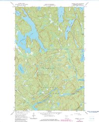
Other maps of this area

1954 · International Falls
USGS Topo · 1:250,000

1957 · International Falls
USGS Topo · 1:250,000

1958 · International Falls
USGS Topo · 1:250,000

1963 · Echo Lake
USGS Topo · 1:24,000

1963 · Redhorse Bay
USGS Topo · 1:24,000

1963 · Crane Lake
USGS Topo · 1:24,000

1967 · Namakan Island
USGS Topo · 1:24,000

1967 · Kabustasa Lake
USGS Topo · 1:24,000

1967 · Marion Lake
USGS Topo · 1:24,000

1967 · Hale Bay
USGS Topo · 1:24,000