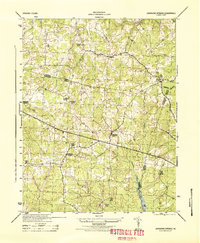
1944 Map of Johnsons Springs
USGS Topo · Published 1944About this map
Johnsons Springs and the surrounding rural communities of Goochland, Hanover, and Henrico counties are captured here in a 1940s War Department survey. The landscape is defined by the winding course of the South Anna River to the north and the extensive drainage networks of Tuckahoe Creek and Goldmine Creek. This era reveals a quiet, agrarian Virginia interior where local life centered on small educational and religious hubs such as the Rockville School and St Matthews Church.
Find a feature on this map
23 named features on this map. Tap any name to fly to it.
Don’t see what you’re looking for? This feature index may not catch every label — zoom into the map to look around manually.
Map Details
Editions of this 1944 Johnsons Springs Map
This is the sole edition of this map. No revisions or reprints were ever made.
Other maps of this area

1890 · Goochland
USGS Topo · 1:125,000

1892 · Goochland
USGS Topo · 1:125,000

1936 · Richmond West
USGS Topo · 1:24,000

1936 · Glen Allen
USGS Topo · 1:24,000

1941 · Glen Allen
USGS Topo · 1:31,680

1942 · Westhampton
USGS Topo · 1:31,680

1943 · Mabelton
USGS Topo · 1:31,680

1943 · Fine Creek Mills
USGS Topo · 1:31,680
1943 · Hanover Academy
USGS Topo · 1:31,680

1943 · Perkinsville
USGS Topo · 1:31,680