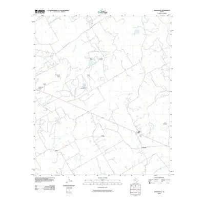
2010 Map of Johnsville
USGS Topo · Published 2010About this map
Johnsville and Selden anchor this rural landscape in Erath County, where the terrain is defined by a network of creeks and small impoundments. The geography is notably marked by family and community history, evidenced by Humberson Cemetery, Aycock Cemetery, and Hatchett Cemetery scattered across the countryside. Water management is a central feature of the local land use, with numerous small reservoirs such as Cross Lake and Warren Lake Number 1 Dam regulating the flow of drainage into Duffau Creek and its tributaries. The settlement at Three Way sits at a critical junction of county roads and state highways like FM 2481, serving as a hub for the surrounding ranching and farming tracts. High points such as Bunker Hill and Lone Mountain provide distinct landmarks in a region otherwise characterized by the winding paths of Pony Creek and Sims Creek.
Find a feature on this map
49 named features on this map. Tap any name to fly to it.
Don’t see what you’re looking for? This feature index may not catch every label — zoom into the map to look around manually.
Map Details
Editions of this 2010 Johnsville Map
This is the sole edition of this map. No revisions or reprints were ever made.
Other maps of this area

1889 · Granbury
USGS Topo · 1:125,000

1890 · Stephenville
USGS Topo · 1:125,000

1920 · Stephenville
USGS Topo · 1:125,000

1931 · Tolar
USGS Topo · 1:62,500

1954 · Dallas
USGS Topo · 1:250,000

1954 · Abilene
USGS Topo · 1:250,000

1958 · Dallas
USGS Topo · 1:250,000

1958 · Abilene
USGS Topo · 1:250,000

1961 · Johnsville
USGS Topo · 1:24,000
1961 · Alexander
USGS Topo · 1:24,000