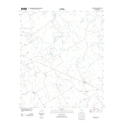
2012 Map of Johnsville
USGS Topo · Published 2012About this map
Selden and the surrounding Erath County countryside are defined by a network of seasonal watercourses and local family landmarks in the early 2010s. The landscape is carved by the drainages of Duffau Creek and Richardson Creek, which feed into several small reservoirs such as Warren Lake Number 2 and Horseshoe Lake. The distribution of Humberson Cem, Aycock Cem, and Hatchett Cem across the quadrangle indicates the persistent locations of early rural communities and family holdings that have long shaped this part of North Central Texas.
Find a feature on this map
48 named features on this map. Tap any name to fly to it.
Don’t see what you’re looking for? This feature index may not catch every label — zoom into the map to look around manually.
Map Details
Editions of this 2012 Johnsville Map
This is the sole edition of this map. No revisions or reprints were ever made.
Other maps of this area

1889 · Granbury
USGS Topo · 1:125,000

1890 · Stephenville
USGS Topo · 1:125,000

1920 · Stephenville
USGS Topo · 1:125,000

1931 · Tolar
USGS Topo · 1:62,500

1954 · Dallas
USGS Topo · 1:250,000

1954 · Abilene
USGS Topo · 1:250,000

1958 · Dallas
USGS Topo · 1:250,000

1958 · Abilene
USGS Topo · 1:250,000

1961 · Johnsville
USGS Topo · 1:24,000
1961 · Alexander
USGS Topo · 1:24,000