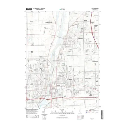
2015 Map of Joliet
USGS Topo · Published 2015About this map
The Des Plaines River and the Illinois and Michigan Canal National Heritage Corridor form the industrial and geographic spine of this Illinois corridor, connecting the major centers of Joliet and Lockport. The landscape is a complex mosaic of suburban expansion and industrial infrastructure, where the Illinois Waterway supports heavy regional transit. Numerous historical burial grounds, including the Russian Cem, Runyan Cem, and Bronson Cem, offer significant data points for genealogists tracing early Will County families. Higher education is well-represented by Lewis Univ and the Univ of Saint Francis. Residential pockets such as Lidice, Fairmont, and Ingalls Park fill the spaces between the river's path and the extensive rail network, including the Rock Island Ave corridor, reflecting the area's long-standing role as a transportation and manufacturing hub.
Find a feature on this map
92 named features on this map. Tap any name to fly to it.
Don’t see what you’re looking for? This feature index may not catch every label — zoom into the map to look around manually.
Map Details
Editions of this 2015 Joliet Map
This is the sole edition of this map. No revisions or reprints were ever made.
Other maps of this area

1890 · Des Plaines
USGS Topo · 1:62,500

1892 · Joliet
USGS Topo · 1:62,500

1892 · Wilmington
USGS Topo · 1:62,500

1894 · Des Plaines
USGS Topo · 1:62,500

1900 · Des Plaines
USGS Topo · 1:62,500

1901 · Des Plaines
USGS Topo · 1:62,500

1918 · Wilmington
USGS Topo · 1:62,500

1923 · Joliet
USGS Topo · 1:62,500

1928 · Sag Bridge
USGS Topo · 1:24,000

1929 · Brisbane
USGS Topo · 1:24,000