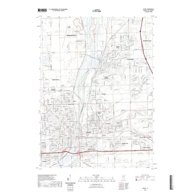
2021 Map of Joliet
USGS Topo · Published 2021About this map
The Des Plaines River corridor serves as the industrial and logistical spine for this portion of Will County, where the historic city of Joliet meets neighbors like Lockport and Romeoville. The landscape is a dense assembly of urban neighborhoods, institutional grounds, and transport infrastructure, including the Will County Courthouse and the Lewis University Airport. Significant land is dedicated to commemorative spaces, ranging from the Russian Cem and Mount Moriah Cem to the Stateville Prison Cem and various parish grounds like Saint Mary Nativity Cem. Small residential enclaves such as Lidice and Fairmont are tucked between rail lines and creek valleys like Fraction Run and Hickory Creek. This arrangement reflects a century of growth driven by the river's utility, with Brandon Bridge marking a key crossing in the south near Rockdale.
Find a feature on this map
78 named features on this map. Tap any name to fly to it.
Don’t see what you’re looking for? This feature index may not catch every label — zoom into the map to look around manually.
Map Details
Editions of this 2021 Joliet Map
This is the sole edition of this map. No revisions or reprints were ever made.
Other maps of this area

1890 · Des Plaines
USGS Topo · 1:62,500

1892 · Joliet
USGS Topo · 1:62,500

1892 · Wilmington
USGS Topo · 1:62,500

1894 · Des Plaines
USGS Topo · 1:62,500

1900 · Des Plaines
USGS Topo · 1:62,500

1901 · Des Plaines
USGS Topo · 1:62,500

1918 · Wilmington
USGS Topo · 1:62,500

1923 · Joliet
USGS Topo · 1:62,500

1928 · Sag Bridge
USGS Topo · 1:24,000

1929 · Brisbane
USGS Topo · 1:24,000