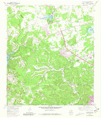
1968 Map of Jollyville
USGS Topo · Published 1981About this map
The Jollyville Plateau dominates the landscape northwest of Austin, serving as a rugged limestone backdrop for the suburban expansion visible in the late 1960s and early 1970s. This survey records the early residential footprints near the Balcones Country Club and the intersection of Anderson Mill Road, illustrating the conversion of ranch land into neighborhoods like Pecan Park. Despite this growth, several small family burial grounds remain preserved, including the Pond Springs Cem, Rhodes Cem, and Jollyville Cem, marking the rural lineage of these settlements.
Find a feature on this map
51 named features on this map. Tap any name to fly to it.
Don’t see what you’re looking for? This feature index may not catch every label — zoom into the map to look around manually.
Map Details
Editions of this 1968 Jollyville Map
Other maps of this area

1893 · Georgetown
USGS Topo · 1:125,000

1896 · Austin
USGS Topo · 1:125,000

1897 · Austin
USGS Topo · 1:125,000

1910 · Austin
USGS Topo · 1:125,000

1928 · Round Rock
USGS Topo · 1:62,500

1930 · Austin-2
USGS Topo · 1:48,000

1932 · Mt. Bonnell
USGS Topo · 1:62,500

1949 · Round Rock
USGS Topo · 1:62,500

1951 · Round Rock
USGS Topo · 1:62,500

1954 · Austin East
USGS Topo · 1:24,000