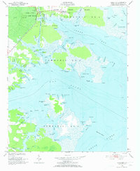
1950 Map of Jones Bay
USGS Topo · Published 1974About this map
The low-lying coastal marshes of Pamlico County are defined here by the intersection of the Intracoastal Waterway and the expansive Jones Bay. This 1950 field-checked survey highlights the remote fishing and maritime communities of Hobucken and Spencer, where life centered on the complex network of tidal creeks and the proximity to the U S Coast Guard Reservation. To the west, the Goose Creek State Game Refuge and Gum Swamp preserve the wild character of the landscape, while family-named points like Persimmon Tree Point and Minktrap Pt suggest the traditional use of these shores for sustenance and navigation. A notable piece of industrial history is found in the Tramway Abandoned near Spencer, hinting at earlier logging or transport efforts within the dense swamp and island terrain before mid-century modernizations took hold.
Find a feature on this map
123 named features on this map. Tap any name to fly to it.
Don’t see what you’re looking for? This feature index may not catch every label — zoom into the map to look around manually.
Map Details
Editions of this 1950 Jones Bay Map
4 editions found
Other maps of this area

1948 · Oriental
USGS Topo · 1:24,000

1949 · Point Of Marsh
USGS Topo · 1:24,000

1950 · Point Of Marsh
USGS Topo · 1:24,000

1950 · Vandemere
USGS Topo · 1:24,000

1950 · Lowland
USGS Topo · 1:24,000

1950 · South Creek
USGS Topo · 1:24,000

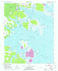
1950 · Jones Bay
USGS Topo · 1:24,000

1951 · Brant Island
USGS Topo · 1:24,000

1951 · Broad Creek
USGS Topo · 1:24,000

1951 · Pamlico Point
USGS Topo · 1:24,000