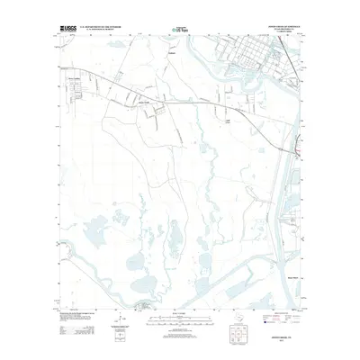
2013 Map of Jones Creek
USGS Topo · Published 2013About this map
The Brazos River and San Bernard River converge toward the Gulf of Mexico on this coastal Texas survey, defining a landscape of low-lying bayous and salt marshes. The settlement of Jones Creek serves as a central hub, with residential growth stretching west toward Perry Landing along Stephen F Austin Rd. This 2013 edition documents the area's intricate water network, including McNeal Bayou, Redfish Bayou, and the Old Intracoastal Waterway which cuts through the southern marshes. Industrial and strategic presence is noted in the northeast corner with Electric Rd and the Bryan Mound area, while local history is anchored by the Velasco Cem. The map illustrates how local infrastructure, from the roads of Oakland to the reach of Bryan Beach, is fundamentally shaped by the surrounding wetlands and river channels.
Find a feature on this map
71 named features on this map. Tap any name to fly to it.
Don’t see what you’re looking for? This feature index may not catch every label — zoom into the map to look around manually.
Map Details
Editions of this 2013 Jones Creek Map
This is the sole edition of this map. No revisions or reprints were ever made.
Other maps of this area

1943 · Oyster Creek
USGS Topo · 1:31,680

1943 · Jones Creek
USGS Topo · 1:31,680

1943 · Freeport
USGS Topo · 1:31,680

1943 · Cedar Lakes East
USGS Topo · 1:24,000

1943 · Snipe
USGS Topo · 1:31,680

1950 · Houston
USGS Topo · 1:250,000

1951 · Bay City
USGS Topo · 1:250,000

1952 · Cedar Lane NE
USGS Topo · 1:24,000

1952 · Cedar Lakes West
USGS Topo · 1:24,000

1952 · Brazoria
USGS Topo · 1:24,000