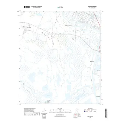
2019 Map of Jones Creek
USGS Topo · Published 2019About this map
Brazos River and San Bernard River outlets define this coastal landscape on the Texas Gulf, where industrial development meets a complex network of wetlands and bayous. The heavy industrial footprint of Dow Operations Plant B in Lake Jackson stands in stark contrast to the sprawling marshes surrounding McNeal Lake and Pelican Lake. The map details the transition from residential areas like Jones Creek and Perry Landing into the tidal flats and lagoons of the Gulf coast. Transportation and shipping are central to the region's character, evidenced by the Intracoastal Waterway and the Old Intracoastal Waterway cutting through the low-lying terrain near Freeport. Local history and land use are preserved in names like Durazno Plantation Rd and the Velasco Cem, anchoring the modern industrial landscape to its earlier agricultural and settlement roots.
Find a feature on this map
65 named features on this map. Tap any name to fly to it.
Don’t see what you’re looking for? This feature index may not catch every label — zoom into the map to look around manually.
Map Details
Editions of this 2019 Jones Creek Map
This is the sole edition of this map. No revisions or reprints were ever made.
Other maps of this area

1943 · Oyster Creek
USGS Topo · 1:31,680

1943 · Jones Creek
USGS Topo · 1:31,680

1943 · Freeport
USGS Topo · 1:31,680

1943 · Cedar Lakes East
USGS Topo · 1:24,000

1943 · Snipe
USGS Topo · 1:31,680

1950 · Houston
USGS Topo · 1:250,000

1951 · Bay City
USGS Topo · 1:250,000

1952 · Cedar Lane NE
USGS Topo · 1:24,000

1952 · Cedar Lakes West
USGS Topo · 1:24,000

1952 · Brazoria
USGS Topo · 1:24,000