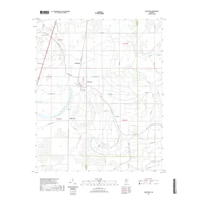
2020 Map of Jonestown
USGS Topo · Published 2020About this map
Jonestown serves as the central hub for this Delta landscape, situated along the Coldwater River where local agriculture and traditional watercourses intersect. The map illustrates a network of rural settlements like Matagorda and Eagles Nest, providing clear evidence of the region's historic property divisions and family burial grounds such as Alcorn Cem and Chrestman Cem. The geography is heavily influenced by relic oxbows and swampy depressions, including Swan Lake and Tula Lake, which dominate the low-lying terrain. Transport and community infrastructure are well-documented, from the Universith of Jonestown to the countless secondary roads like Pear Orchard Rd and Sunrise Rd that link these small communities. The boundary between Coahoma and Quitman counties cuts through the eastern portion of the sheet, dividing the fertile bottomlands between the Broad Bayou and the main river channel.
Find a feature on this map
57 named features on this map. Tap any name to fly to it.
Don’t see what you’re looking for? This feature index may not catch every label — zoom into the map to look around manually.
Map Details
Editions of this 2020 Jonestown Map
This is the sole edition of this map. No revisions or reprints were ever made.
Other maps of this area

1908 · Lula
USGS Topo · 1:24,000

1908 · Coahoma
USGS Topo · 1:24,000

1908 · Moon Lake
USGS Topo · 1:24,000

1908 · Jonestown
USGS Topo · 1:24,000

1910 · Coahoma
USGS Topo · 1:31,680

1910 · Jonestown
USGS Topo · 1:31,680

1912 · Moon Lake
USGS Topo · 1:31,680

1912 · Lula
USGS Topo · 1:31,680

1932 · Tutwiler
USGS Topo · 1:48,000

1932 · Marks
USGS Topo · 1:48,000