
1954 Map of Joplin
USGS Topo · Published 1967About this map
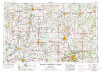
Joplin serves as the industrial and population hub of this mid-century tri-state region, where the borders of Kansas, Missouri, and Oklahoma meet. The landscape is heavily marked by the extraction and production economies of the era, visible in the numerous oil wells and tanks, refineries, and large-scale industrial sites like the Kansas Army Ammunition Plant and the Eagle-Picher Smelter. The map captures a transitional period in regional water management, showing major impoundments such as Elk City Reservoir and Fall River Reservoir alongside the natural courses of the Neosho River and Verdigris River.
Find a feature on this map
366 named features on this map. Tap any name to fly to it.
Don’t see what you’re looking for? This feature index may not catch every label — zoom into the map to look around manually.
Map Details
Editions of this 1954 Joplin Map
Other maps of this area

1884 · Fort Scott
USGS Topo · 1:125,000

1885 · Burlington
USGS Topo · 1:125,000

1885 · Eureka
USGS Topo · 1:125,000

1885 · Garnett
USGS Topo · 1:125,000

1885 · Sedan
USGS Topo · 1:125,000

1886 · Nevada
USGS Topo · 1:125,000

1886 · Fredonia
USGS Topo · 1:125,000

1886 · Joplin
USGS Topo · 1:125,000

1886 · Stockton
USGS Topo · 1:125,000

1886 · Greenfield
USGS Topo · 1:125,000