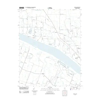
2012 Map of Joppa
USGS Topo · Published 2012About this map
The Ohio River dominates the center of this landscape, serving as a state boundary and a corridor for river commerce near Joppa. To the north, the terrain is defined by low-lying wetlands and seasonal water bodies like Mermet Lake and Snake Slough, while a network of rural roads connects established settlements such as Choat and Rossington. The map reveals a high density of small family and community burial sites, including Kirkendall Cem, Liberty Ridge Cem, and Martin Cem, reflecting the deep-rooted settlement history of Massac County. Further east, the Metropolis Municipal Airport and the waters of Metropolis Lake show the intersection of modern infrastructure and the natural riverine environment. Local drainage is managed by a series of named waterways like Nasty Cr and Bayou Cr, which meander through the agricultural lands and bottomlands that characterize this river-bend region.
Find a feature on this map
108 named features on this map. Tap any name to fly to it.
Don’t see what you’re looking for? This feature index may not catch every label — zoom into the map to look around manually.
Map Details
Editions of this 2012 Joppa Map
This is the sole edition of this map. No revisions or reprints were ever made.
Other maps of this area

1917 · Brownfield
USGS Topo · 1:62,500

1918 · Vienna
USGS Topo · 1:62,500

1919 · Vienna
USGS Topo · 1:62,500

1926 · Paducah
USGS Topo · 1:62,500

1928 · La Center
USGS Topo · 1:62,500

1929 · Paducah
USGS Topo · 1:62,500

1932 · La Center
USGS Topo · 1:62,500

1940 · Paducah
USGS Topo · 1:62,500

1942 · Vienna
USGS Topo · 1:62,500

1949 · Paducah
USGS Topo · 1:250,000