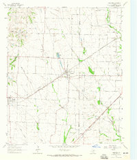
1963 Map of Josephine
USGS Topo · Published 1965About this map
Josephine sits at the center of this rural landscape along the St Louis Southwestern rail line, serving as a primary hub during the early 1960s. The region is defined by a dense network of waterways including Sabine Creek, Bois d'Arc Creek, and West Caddo Creek, which carve through the farmland of eastern Collin County. Small rural community centers like Nevada and Pleasant Valley are documented here, alongside local landmarks such as Cooks Lake and the Community Sch.
Find a feature on this map
22 named features on this map. Tap any name to fly to it.
Don’t see what you’re looking for? This feature index may not catch every label — zoom into the map to look around manually.
Map Details
Editions of this 1963 Josephine Map
2 editions found
Other maps of this area

1912 · Rockwall
USGS Topo · 1:31,680

1919 · Royse City
USGS Topo · 1:62,500

1924 · Farmersville 3-c
USGS Topo · 1:48,000

1930 · Farmersville
USGS Topo · 1:62,500

1954 · Dallas
USGS Topo · 1:250,000

1954 · Sherman
USGS Topo · 1:250,000

1956 · Quinlan
USGS Topo · 1:62,500

1958 · Dallas
USGS Topo · 1:250,000

1958 · Sherman
USGS Topo · 1:250,000

1960 · Culleoka
USGS Topo · 1:24,000