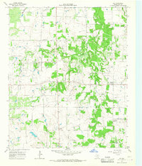
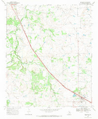
1964 Map of Joy
USGS Topo · Published 1967About this map
Joy Oil Field dominates the western landscape of this mid-1960s survey, illustrating the petroleum-driven economy of rural Clay County. The settlement of Joy sits at the center of this activity, flanked by the Joy Cem and a nearby substation. The topography is defined by the winding course of the Little Wichita River and its East Fork, which create a network of drainage including Halsell Creek and Lodge Creek.
Find a feature on this map
18 named features on this map. Tap any name to fly to it.
Don’t see what you’re looking for? This feature index may not catch every label — zoom into the map to look around manually.
Map Details
Editions of this 1964 Joy Map
This is the sole edition of this map. No revisions or reprints were ever made.
Other maps of this area

1954 · Wichita Falls
USGS Topo · 1:250,000

1958 · Wichita Falls
USGS Topo · 1:250,000

1962 · Antelope Creek NE
USGS Topo · 1:24,000

1963 · Deer Creek
USGS Topo · 1:24,000
1963 · Vashti
USGS Topo · 1:24,000
1964 · Newport
USGS Topo · 1:24,000

1964 · Antelope
USGS Topo · 1:24,000

1964 · Scotland SE
USGS Topo · 1:24,000
1964 · Postoak
USGS Topo · 1:24,000
1968 · Bellevue
USGS Topo · 1:24,000