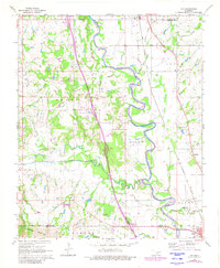
1965 Map of Joy
USGS Topo · Published 1980About this map
The Washita River meanders through a landscape defined by both agrarian life and industrial extraction along the Garvin and Murray County line. This mid-1960s survey captures a transition in the region, where the oil fields of Northeast Butterly and South Butterly sit alongside established ranching and farming communities. The presence of the Fort Arbuckle Ruins near Hoover provides a tangible link to the mid-19th century frontier history of the area.
Find a feature on this map
33 named features on this map. Tap any name to fly to it.
Don’t see what you’re looking for? This feature index may not catch every label — zoom into the map to look around manually.
Map Details
Editions of this 1965 Joy Map
2 editions found

Other maps of this area

1898 · Pauls Valley
USGS Topo · 1:125,000

1901 · Ardmore
USGS Topo · 1:125,000

1902 · Pauls Valley
USGS Topo · 1:125,000

1918 · Ardmore
USGS Topo · 1:125,000

1957 · Ardmore
USGS Topo · 1:250,000

1963 · Ardmore
USGS Topo · 1:250,000

1964 · Turner Falls
USGS Topo · 1:24,000

1965 · Pauls Valley NE
USGS Topo · 1:24,000

1965 · Pauls Valley
USGS Topo · 1:24,000

1965 · Davis
USGS Topo · 1:24,000