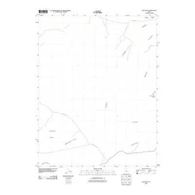
2010 Map of Jug Rock
USGS Topo · Published 2010About this map
Jug Rock and the surrounding high desert terrain define this corner of Grand County as it was documented in 2010. The landscape is dominated by complex drainage systems and prominent geological markers, including the Determination Towers and the broad expanse of Bartlett Flat. Access to this arid region is provided by several established routes such as Dubinky Well Rd and Mineral Bottom Rd, which navigate between the steep-walled Tusher Canyon and Mill Canyon. The map highlights the intersection of transportation and topography, notably at Canyonlands Field. This survey captures the intricate network of seasonal washes, including Tenmile Wash and Bartlett Wash, and the scattered water sources like Brink Spring that have long dictated movement across the Klondike Flat and toward Lone Mesa.
Find a feature on this map
18 named features on this map. Tap any name to fly to it.
Don’t see what you’re looking for? This feature index may not catch every label — zoom into the map to look around manually.
Map Details
Editions of this 2010 Jug Rock Map
This is the sole edition of this map. No revisions or reprints were ever made.
Other maps of this area

1885 · La Sal
USGS Topo · 1:250,000

1951 · The Knoll
USGS Topo · 1:62,500

1952 · Moab 4 NW
USGS Topo · 1:24,000

1952 · Moab 3 NE
USGS Topo · 1:24,000

1952 · Moab 3 SE
USGS Topo · 1:24,000

1952 · Moab 3 SW
USGS Topo · 1:24,000

1952 · Moab 4 SW
USGS Topo · 1:24,000

1952 · Moab 3 NW
USGS Topo · 1:24,000

1956 · Moab
USGS Topo · 1:250,000

1958 · Crescent Junction
USGS Topo · 1:62,500