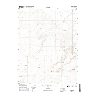
2014 Map of Jug Rock
USGS Topo · Published 2014About this map
Jug Rock stands as a primary landmark in this arid Grand County landscape, where deep drainages like Sevenmile Canyon and Tusher Canyon carve through high desert mesas. The terrain is defined by a network of expansive flats, including Bartlett Flat and Klondike Flat, which historically provided passage through this complex topography. Natural water sources are scarce, marked only by the occasional Brink Spring or the seasonal flow of Tenmile Wash. The presence of the Tusher Tunnel and the distinctive Determination Towers highlights a landscape where geology and early exploration intersected. This modern survey by the U.S. Geological Survey captures the corridor along Ut-313, illustrating the paths used to navigate between Lone Mesa and the surrounding canyon floors.
Find a feature on this map
19 named features on this map. Tap any name to fly to it.
Don’t see what you’re looking for? This feature index may not catch every label — zoom into the map to look around manually.
Map Details
Editions of this 2014 Jug Rock Map
This is the sole edition of this map. No revisions or reprints were ever made.
Other maps of this area

1885 · La Sal
USGS Topo · 1:250,000

1951 · The Knoll
USGS Topo · 1:62,500

1952 · Moab 4 NW
USGS Topo · 1:24,000

1952 · Moab 3 NE
USGS Topo · 1:24,000

1952 · Moab 3 SE
USGS Topo · 1:24,000

1952 · Moab 3 SW
USGS Topo · 1:24,000

1952 · Moab 4 SW
USGS Topo · 1:24,000

1952 · Moab 3 NW
USGS Topo · 1:24,000

1956 · Moab
USGS Topo · 1:250,000

1958 · Crescent Junction
USGS Topo · 1:62,500