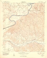
1949 Map of Julia
USGS Topo · Published 1949About this map
The Chattahoochee River carves a deep boundary between Alabama and Georgia in the late 1940s, defining the landscape and the jurisdictional limits of Russell, Stewart, and Chattahoochee counties. To the north, the Fort Benning Military Reservation occupies a significant portion of the terrain, while the southern reaches are characterized by numerous family-named homesteads and small agricultural holdings. The Seaboard Air Line railroad tracks parallel Hannahatchee Creek in the south, connecting the settlement of Julia to the wider region. This survey captures a specific moment of rural life where local landmarks like the Blessed Trinity Mission and the Fitzgerald Cem served as community hubs. The distribution of sites such as Upper Bradley Place, Heard Place, and Slayton Place provides researchers with a clear record of land ownership and residency patterns before significant modern redevelopment.
Find a feature on this map
21 named features on this map. Tap any name to fly to it.
Don’t see what you’re looking for? This feature index may not catch every label — zoom into the map to look around manually.
Map Details
Editions of this 1949 Julia Map
2 editions found
Other maps of this area

1908 · Columbus
USGS Topo · 1:62,500

1914 · Seale
USGS Topo · 1:62,500

1929 · Columbus
USGS Topo · 1:48,000

1947 · Columbus
USGS Topo · 1:62,500

1949 · Fort Mitchell
USGS Topo · 1:24,000

1949 · Julia
USGS Topo · 1:24,000

1949 · Cusseta
USGS Topo · 1:24,000

1950 · Fort Benning
USGS Topo · 1:24,000

1950 · Louvale
USGS Topo · 1:24,000

1950 · Lumpkin
USGS Topo · 1:24,000