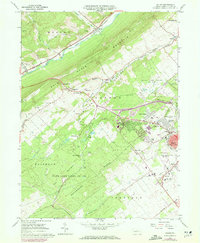
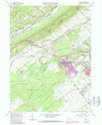
1962 Map of Julian
USGS Topo · Published 1972About this map
State College anchors the southeastern corner of this landscape, showing the expansion of residential developments like Park Forest Village and Woodycrest during the early 1970s. The region is defined by the sharp parallel ridges of Bald Eagle Mountain and Patten Ridge, which frame the Bald Eagle Valley and its transportation corridors. The Bellefonte Central Railroad and Penn Central tracks trace the lowlands, connecting small settlements like Julian and Waddle.
Find a feature on this map
54 named features on this map. Tap any name to fly to it.
Don’t see what you’re looking for? This feature index may not catch every label — zoom into the map to look around manually.
Map Details
Editions of this 1962 Julian Map
5 editions found
Other maps of this area

1908 · Bellefonte
USGS Topo · 1:62,500

1909 · Bellefonte
USGS Topo · 1:62,500

1919 · Menno
USGS Topo · 1:62,500

1922 · Philipsburg
USGS Topo · 1:62,500

1923 · Tyrone
USGS Topo · 1:62,500

1929 · Tyrone
USGS Topo · 1:48,000

1933 · Tyrone
USGS Topo · 1:62,500

1935 · Allensville
USGS Topo · 1:62,500

1938 · Allensville
USGS Topo · 1:62,500

1939 · Philipsburg
USGS Topo · 1:62,500