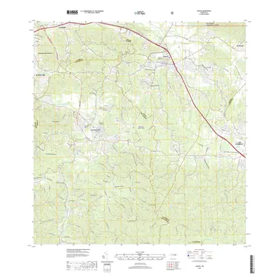
2018 Map of Juncos
USGS Topo · Published 2018About this map
Juncos and San Lorenzo serve as the primary hubs in this part of the Island of Puerto Rico, where the urban centers meet the foothills of the Luquillo Mountains. The landscape is defined by a dense network of watercourses, including the Rio Gurabo and the Rio Grande De Loiza, which drain the surrounding high ground. In the northeast, the terrain rises toward El Yunque National Forest, a significant landmark that shapes the local geography. Several historic burial sites, such as the Cementerio Municipal Viejo de Juncos and Cementerio El Remanso, are established near the municipal borders, providing important points of interest for genealogical research. The expansion of modern infrastructure is evident through the Expreso Chayane, which connects the larger settlements to the neighboring regions of Caguas and Gurabo. Smaller rural communities like Piedra Blanca and El Mangó remain scattered throughout the valleys, illustrating the traditional settlement patterns of the interior.
Find a feature on this map
38 named features on this map. Tap any name to fly to it.
Don’t see what you’re looking for? This feature index may not catch every label — zoom into the map to look around manually.
Map Details
Editions of this 2018 Juncos Map
This is the sole edition of this map. No revisions or reprints were ever made.
Other maps of this area

1945 · El Yunque
USGS Topo · 1:30,000

1946 · Patillas
USGS Topo · 1:30,000

1946 · El Yunque
USGS Topo · 1:30,000

1946 · Aguas Buenas
USGS Topo · 1:30,000

1946 · Humacao
USGS Topo · 1:30,000

1946 · Punta Guayanes
USGS Topo · 1:30,000

1946 · Gurabo
USGS Topo · 1:30,000

1946 · Juncos
USGS Topo · 1:30,000

1946 · Yabucoa
USGS Topo · 1:30,000

1946 · Caguas
USGS Topo · 1:30,000