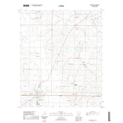
2020 Map of Junction City
USGS Topo · Published 2020About this map
Junction City straddles the Arkansas-Louisiana border, serving as the primary hub for a landscape defined by the branching tributaries of the Little Cornie Bayou. This recent survey illustrates the rural settlement patterns of Union County, Arkansas, and Claiborne Parish, Louisiana, where small communities like Caledonia and New Caledonia are centered around family-named landmarks and historical burial grounds. The terrain is marked by timber and resource activity, with roads like Oil Field Rd and S Field Cutoff suggesting the region's industrial ties.
Find a feature on this map
113 named features on this map. Tap any name to fly to it.
Don’t see what you’re looking for? This feature index may not catch every label — zoom into the map to look around manually.
Map Details
Editions of this 2020 Junction City Map
This is the sole edition of this map. No revisions or reprints were ever made.
Other maps of this area

1927 · El Dorado
USGS Topo · 1:62,500

1930 · El Dorado
USGS Topo · 1:62,500

1951 · Summerfield
USGS Topo · 1:62,500

1951 · Bernice
USGS Topo · 1:62,500

1951 · El Dorado
USGS Topo · 1:62,500

1953 · El Dorado
USGS Topo · 1:250,000

1955 · Shreveport
USGS Topo · 1:250,000

1956 · Shreveport
USGS Topo · 1:250,000

1957 · El Dorado
USGS Topo · 1:250,000

1958 · El Dorado
USGS Topo · 1:250,000