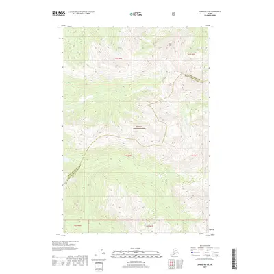
2017 Map of Juneau A-2 SW
USGS Topo · Published 2017About this map
Eagle Peak dominates the northern reaches of this high-elevation coastal wilderness, where the jagged topography of the Tongass National Forest defines the regional character. This 2017 survey documents the transition across the Juneau Borough Hoonah-Angoon Census Area boundary, tracing a landscape shaped by glacial action and dense drainage networks. The map details the headwaters and upper reaches of Greens Cr in the west and the King Salmon River in the east, reflecting the intense seasonal runoff typical of the Alaskan Panhandle. While largely devoid of named human settlements, the map identifies specific township and range blocks including t43s r66e, providing a precise grid for modern land management and historical surveying within one of the nation's largest national forests.
Find a feature on this map
11 named features on this map. Tap any name to fly to it.
Don’t see what you’re looking for? This feature index may not catch every label — zoom into the map to look around manually.
Map Details
Editions of this 2017 Juneau A-2 SW Map
This is the sole edition of this map. No revisions or reprints were ever made.
Other maps of this area

1948 · Juneau A-3
USGS Topo · 1:63,360

1948 · Sitka D-3
USGS Topo · 1:63,360

1948 · Sitka D-2
USGS Topo · 1:63,360

1950 · Juneau A-3
USGS Topo · 1:63,360

1951 · Juneau
USGS Topo · 1:250,000

1951 · Juneau A-2
USGS Topo · 1:63,360

1951 · Sitka
USGS Topo · 1:250,000

1951 · Sitka D-3
USGS Topo · 1:63,360

1951 · Sitka D-2
USGS Topo · 1:63,360

1952 · Sitka
USGS Topo · 1:250,000