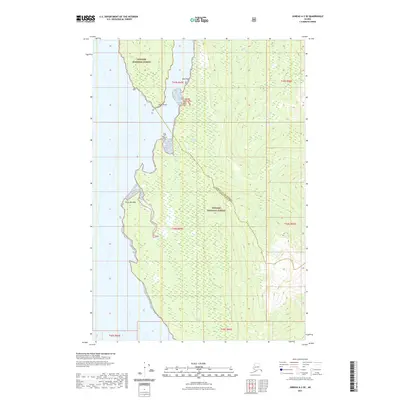
2021 Map of Juneau A-3 SE
USGS Topo · Published 2021About this map
Tongass National Forest covers the vast majority of this coastal landscape, situated at the boundary of the Junreau City and Borough Hoonah-Angoon Census Area. The shoreline is defined by prominent geographical features like Point Marsden and Hawk Point, while the interior is marked by significant drainages including Wheeler Cr and Greens Cr. This map documents a largely undeveloped stretch of Southeast Alaska, where the topography rises sharply from the saltwater to the high ridges of the national forest. The inclusion of Bare Rock and Piledriver Cove provides specific navigational and landmark data for this maritime environment as it was surveyed in the early 2020s.
Find a feature on this map
15 named features on this map. Tap any name to fly to it.
Don’t see what you’re looking for? This feature index may not catch every label — zoom into the map to look around manually.
Map Details
Editions of this 2021 Juneau A-3 SE Map
This is the sole edition of this map. No revisions or reprints were ever made.
Other maps of this area

1948 · Juneau A-3
USGS Topo · 1:63,360

1948 · Sitka D-3
USGS Topo · 1:63,360

1948 · Sitka D-2
USGS Topo · 1:63,360

1950 · Juneau A-3
USGS Topo · 1:63,360

1951 · Juneau
USGS Topo · 1:250,000

1951 · Juneau A-2
USGS Topo · 1:63,360

1951 · Sitka
USGS Topo · 1:250,000

1951 · Sitka D-3
USGS Topo · 1:63,360

1951 · Sitka D-2
USGS Topo · 1:63,360

1952 · Sitka
USGS Topo · 1:250,000