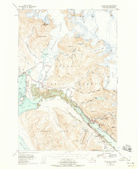
1947 Map of Juneau B-2
USGS Topo · Published 1958About this map
Juneau and the surrounding gold-mining landscape of the First Judicial Division are captured here during a period of post-war transition. The industrial legacy of the region is prominent, specifically at the Alaska-Juneau Mill and the Treadwell site across the Gastineau Channel on Douglas Island. These sites reflect the massive scale of early 20th-century hard-rock mining that shaped the capital's early economy. Further inland, the map details the infrastructure required for such operations, including the Salmon Creek Dam and a series of powerhouses and tramways.
Find a feature on this map
76 named features on this map. Tap any name to fly to it.
Don’t see what you’re looking for? This feature index may not catch every label — zoom into the map to look around manually.
Map Details
Editions of this 1947 Juneau B-2 Map
2 editions found
Other maps of this area

1947 · Juneau B-3
USGS Topo · 1:63,360

1947 · Juneau B-2
USGS Topo · 1:63,360

1948 · Juneau A-3
USGS Topo · 1:63,360

1948 · Juneau B-1
USGS Topo · 1:63,360

1949 · Juneau B-3
USGS Topo · 1:62,500

1949 · Juneau B-2
USGS Topo · 1:62,500

1950 · Juneau A-3
USGS Topo · 1:63,360

1951 · Juneau
USGS Topo · 1:250,000

1951 · Juneau A-2
USGS Topo · 1:63,360

1951 · Juneau A-1
USGS Topo · 1:63,360