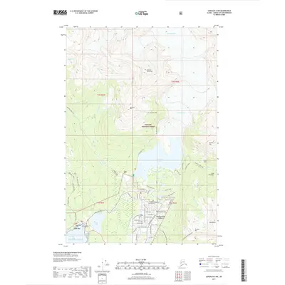
2017 Map of Juneau B-2 NW
USGS Topo · Published 2017About this map
Mendenhall Valley and the residential core of Mendenhaven serve as the focal point for this 2017 survey of Alaska's coastal landscape. The map illustrates a complex relationship between modern development and massive geological features, where neighborhoods give way to the Tongass National Forest and the retreating Mendenhall Glacier. Near the coast, Auke Bay supports both the University of Alaska Southeast campus and maritime activities, while Auke Lake provides a central freshwater landmark.
Find a feature on this map
50 named features on this map. Tap any name to fly to it.
Don’t see what you’re looking for? This feature index may not catch every label — zoom into the map to look around manually.
Map Details
Editions of this 2017 Juneau B-2 NW Map
This is the sole edition of this map. No revisions or reprints were ever made.
Other maps of this area

1947 · Juneau B-3
USGS Topo · 1:63,360

1947 · Juneau B-2
USGS Topo · 1:63,360

1949 · Juneau B-3
USGS Topo · 1:62,500

1949 · Juneau B-2
USGS Topo · 1:62,500

1951 · Juneau
USGS Topo · 1:250,000

1951 · Juneau C-3
USGS Topo · 1:63,360

1952 · Juneau C-3
USGS Topo · 1:63,360

1960 · Juneau C-2
USGS Topo · 1:63,360

1962 · Juneau B-2
USGS Topo · 1:63,360

1962 · Juneau B-3
USGS Topo · 1:63,360