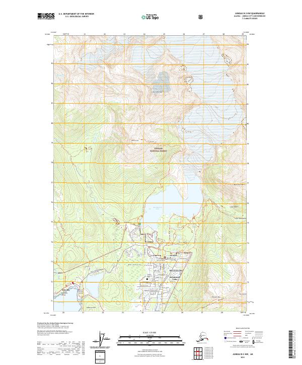
2021 Map of Juneau B-2 NW
USGS Topo · Published 2021About this map
Mendenhall Valley serves as a primary residential hub north of Juneau, characterized by a dense suburban grid that transitions into the glacial wilderness of the Tongass National Forest. The landscape is dominated by the massive Mendenhall Lake, fed by various glacial streams including Steep Cr and Nugget Cr, while the residential corridors of Mendenhaven and Tlaxsatanyin sit at the feet of the Coast Mountains. To the west, the University of Alaska Southeast campus overlooks the waters of Auke Lake and the coastal inlet at Auke Bay. Significant recreational and memorial sites are interspersed with the natural terrain, including Alaskan Memorial Park and the trailhead at Skaters Cabin. This map illustrates the intersection of modern Alaskan infrastructure with the formidable topography of Heintzleman Ridge and Thunder Mtn, showing how the community has integrated into the narrow valleys below the glacier.
Find a feature on this map
65 named features on this map. Tap any name to fly to it.
Don’t see what you’re looking for? This feature index may not catch every label — zoom into the map to look around manually.
Map Details
Editions of this 2021 Juneau B-2 NW Map
This is the sole edition of this map. No revisions or reprints were ever made.
Other maps of this area

1947 · Juneau B-3
USGS Topo · 1:63,360

1947 · Juneau B-2
USGS Topo · 1:63,360

1949 · Juneau B-3
USGS Topo · 1:62,500

1949 · Juneau B-2
USGS Topo · 1:62,500

1951 · Juneau
USGS Topo · 1:250,000

1951 · Juneau C-3
USGS Topo · 1:63,360

1952 · Juneau C-3
USGS Topo · 1:63,360

1960 · Juneau C-2
USGS Topo · 1:63,360

1962 · Juneau B-2
USGS Topo · 1:63,360

1962 · Juneau B-3
USGS Topo · 1:63,360