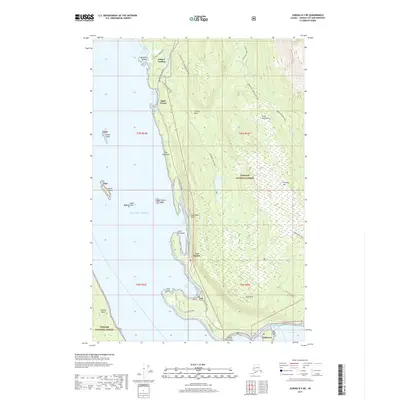
2017 Map of Juneau B-3 NE
USGS Topo · Published 2017About this map
Tee Harbor serves as a central coastal landmark on this coastal Alaskan landscape, where the Glacier Highway skirts the edge of the Tongass National Forest. Small coastal settlements like Dobson Landing and Saint Terese are tucked along the shoreline of the Gulf of Alaska, connected by a network of local roads including Shrine Rd and Lena Loop. The terrain is defined by dramatic coastal features such as The Breadline and Point Stephens, while the interior rises toward Auke Mtn and Treasury Hill. Hikers and outdoorsmen can trace established routes like the Peterson Lake Trail and the Spaulding Trail that navigate the slopes of the Coast Mountains. This modern survey illustrates the proximity of residential areas like Fairhaven to the expansive wilderness of the national forest and the aquatic habitats surrounding Shelter Island.
Find a feature on this map
55 named features on this map. Tap any name to fly to it.
Don’t see what you’re looking for? This feature index may not catch every label — zoom into the map to look around manually.
Map Details
Editions of this 2017 Juneau B-3 NE Map
This is the sole edition of this map. No revisions or reprints were ever made.
Other maps of this area

1947 · Juneau B-3
USGS Topo · 1:63,360

1947 · Juneau B-2
USGS Topo · 1:63,360

1949 · Juneau B-3
USGS Topo · 1:62,500

1949 · Juneau B-2
USGS Topo · 1:62,500

1951 · Juneau
USGS Topo · 1:250,000

1951 · Juneau C-3
USGS Topo · 1:63,360

1952 · Juneau C-3
USGS Topo · 1:63,360

1960 · Juneau C-2
USGS Topo · 1:63,360

1962 · Juneau B-2
USGS Topo · 1:63,360

1962 · Juneau B-3
USGS Topo · 1:63,360