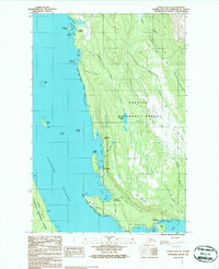
1986 Map of Juneau B-3 NE
USGS Topo · Published 1987About this map
Tongass National Forest dominates this coastal landscape north of Juneau, where the rugged shoreline of the Favorite Channel meets the steep slopes of Auke Mountain. Small settlements and landings like Dotsons Landing and Fairhaven appear alongside established recreation sites such as the Lena Beach Recreation Area. Notable landmarks including the Shrine of St Terese and the secondary Shrine to the south indicate the spiritual and cultural imprint on this wilderness edge. The shoreline is defined by a series of protected coves and harbors, from Amalga Harbor and Huffman Harbor in the north to Tee Harbor and the wide reach of Auke Bay in the south. Inland, the map details a network of drainages including Peterson Creek and Montana Creek that feed into the saltwater, reflecting a geography where transportation was historically tethered to the water and coastal routes like The Breadline.
Find a feature on this map
41 named features on this map. Tap any name to fly to it.
Don’t see what you’re looking for? This feature index may not catch every label — zoom into the map to look around manually.
Map Details
Editions of this 1986 Juneau B-3 NE Map
This is the sole edition of this map. No revisions or reprints were ever made.
Other maps of this area

1947 · Juneau B-3
USGS Topo · 1:63,360

1947 · Juneau B-2
USGS Topo · 1:63,360

1949 · Juneau B-3
USGS Topo · 1:62,500

1949 · Juneau B-2
USGS Topo · 1:62,500

1951 · Juneau
USGS Topo · 1:250,000

1951 · Juneau C-3
USGS Topo · 1:63,360

1952 · Juneau C-3
USGS Topo · 1:63,360

1960 · Juneau C-2
USGS Topo · 1:63,360

1962 · Juneau B-2
USGS Topo · 1:63,360

1962 · Juneau B-3
USGS Topo · 1:63,360