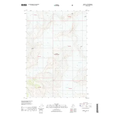
2017 Map of Juneau C-2 SW
USGS Topo · Published 2017About this map
Tongass National Forest dominates this Alaskan landscape, where massive ice fields and high peaks of the Coast Mountains shape the terrain. The survey captures the intricate contours of the Herbert Glacier, which occupies the central and southern portions of the sheet, and the southern edge of the Eagle Glacier to the north. These glaciers provide a detailed look at the glacial movement and drainage patterns into the Mendenhall Glacier system. Notable high points like Mt Ernest Gruening and the Folded Towers stand as prominent landmarks among the ice. The map serves as a precise record of these shifting ice masses and alpine features, including Triangle Peak, during the early 21st century, reflecting a wilderness untouched by roads or permanent settlements.
Find a feature on this map
14 named features on this map. Tap any name to fly to it.
Don’t see what you’re looking for? This feature index may not catch every label — zoom into the map to look around manually.
Map Details
Editions of this 2017 Juneau C-2 SW Map
This is the sole edition of this map. No revisions or reprints were ever made.
Other maps of this area

1947 · Juneau B-3
USGS Topo · 1:63,360

1947 · Juneau B-2
USGS Topo · 1:63,360

1949 · Juneau B-3
USGS Topo · 1:62,500

1949 · Juneau B-2
USGS Topo · 1:62,500

1951 · Juneau
USGS Topo · 1:250,000

1951 · Juneau C-3
USGS Topo · 1:63,360

1952 · Juneau C-3
USGS Topo · 1:63,360

1960 · Juneau C-2
USGS Topo · 1:63,360

1962 · Juneau B-2
USGS Topo · 1:63,360

1962 · Juneau B-3
USGS Topo · 1:63,360